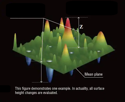
how to get the real height (Z) from 2D image
Hello, I am new to image processing, and I'm working on creating topographic maps of 2D image depending on a grayscale of images using python. I convert the 2D RGB image to grayscale and each pixel has values from 0 to 255, then I draw the topographic map depending on the value of each pixel in the image which represents the height (Z) as shown in the photo below. but how to get the real height (Z) ?


255 is max, 128 is mean, and 0 is min. Since it's RGB, the max is a function of the decay of the speed of light and the shutter speed
to improve your question, please show:
and, how is this all related to opencv, a computer-vision library (it all seems more GIS related)
Is this about getting the real dimensions(like in cm) of an object in an image? If so - this sounds interesting and relevant.
yes , this is about getting the real dimensions